Key Takeaways:
- Geofencing is a technology that allows you to create virtual boundaries around specific areas in which you want to monitor activities using GPS, RFID, Wi-Fi, or cellular data.
- Geofencing has the power to protect your assets from construction site theft, minimize downtime and maximize productivity, and help you make data-driven decisions.
- Depending on your needs, you can create polygon geofences for irregularly shaped areas, circular ones for creating simple perimeters, or corridor geofences, typically used along transportation routes or pathways.
You are strolling by a favorite coffee spot, and suddenly, your phone pings, tempting you with a discount on your usual order.
Believe it or not, that’s geofencing in action—but in marketing.
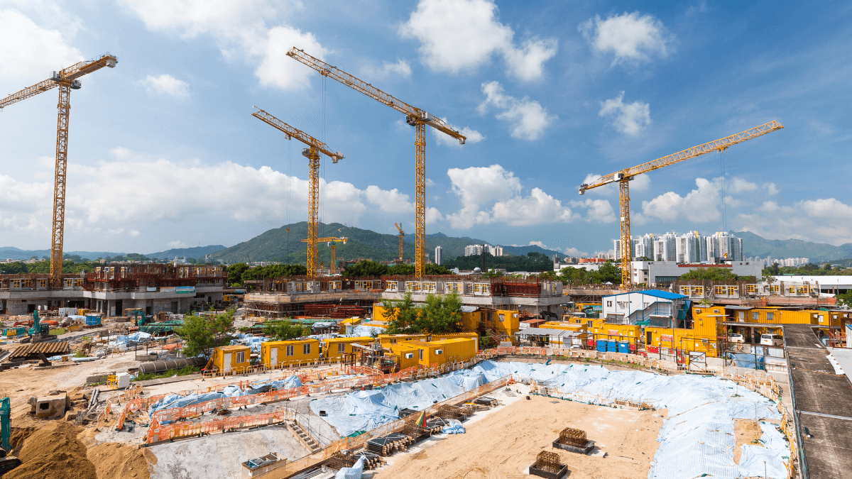
Geofencing in construction works similarly, but instead of creating digital boundaries to entice shoppers, it is about creating digital boundaries around job sites or equipment yards.
Why? To protect your fleet, enhance worker safety, and improve the overall efficiency of your construction operations.
In the next few chapters, we will dive into geofencing, explain what it is, how it works, and why it’s high time you use it in your construction company.
Let’s jump right into it.
In this article...
What Is Geofencing
Imagine if you could put up fences around specific areas without the need for physical barriers.
That’s the essence of geofencing—creating virtual boundaries using technology like GPS, RFID, Wi-Fi, or cellular data.
It’s like drawing invisible lines around places of interest, allowing you to monitor activities within those areas in real time.
It’s simple: when an object with a GPS tracker, for example, enters this boundary or exits it, you get notified through an app, software, or platform.
In everyday life, geofencing shows up in various scenarios.
It can be applied in agriculture to create virtual boundaries or perimeters around grazing areas or fields.
For instance, by equipping animals with GPS-enabled collars or tags, farmers can monitor their movements and receive alerts if they stray beyond the predefined boundaries.
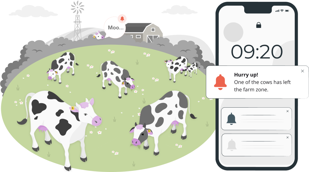
Geofencing even aids in wildlife monitoring and conservation, helping to protect endangered species or prevent human-wildlife conflicts.
It is also used in marketing to target consumers based on their location.
On the other hand, fleet managers use geofencing to track vehicles more efficiently, as well as ensure compliance and safety.
For instance, they can set up virtual boundaries around areas with specific speed limits or hazardous conditions.
When a vehicle enters these predefined zones, fleet managers (or drivers themselves) receive instant alerts, which allows them to exit these areas immediately, thus minimizing safety risks.
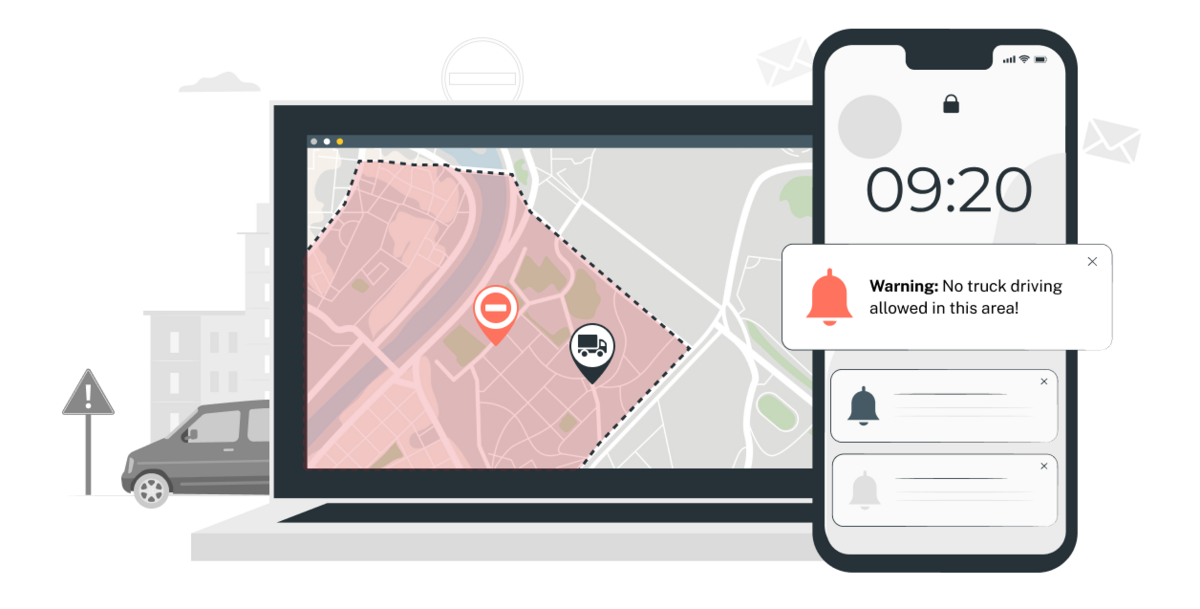
Geofencing in construction has a similar purpose.
As a construction company owner, overseeing multiple job sites and equipment yards is part of your daily routine.
Geofencing allows you to set virtual perimeters around these areas to monitor equipment movements, track your personnel, and, most importantly, enhance site security.
Exciting stuff, right?
But before we dive deeper into all the benefits of geofencing for your construction company, let’s take a closer look at how geofencing actually works.
How Does It Work
Geofencing may sound complex, but let’s break it down to show you how simple and effective it can be.
At its core, geofencing creates virtual boundaries around specific areas using GPS, RFID, Wi-Fi, or cellular data.
These boundaries, known as geofences, are established and then monitored with the help of specialized hardware and software.
In fact, according to Dev Bhatia, former Chief Marketing Officer for Momentum IoT, you need three essential components:
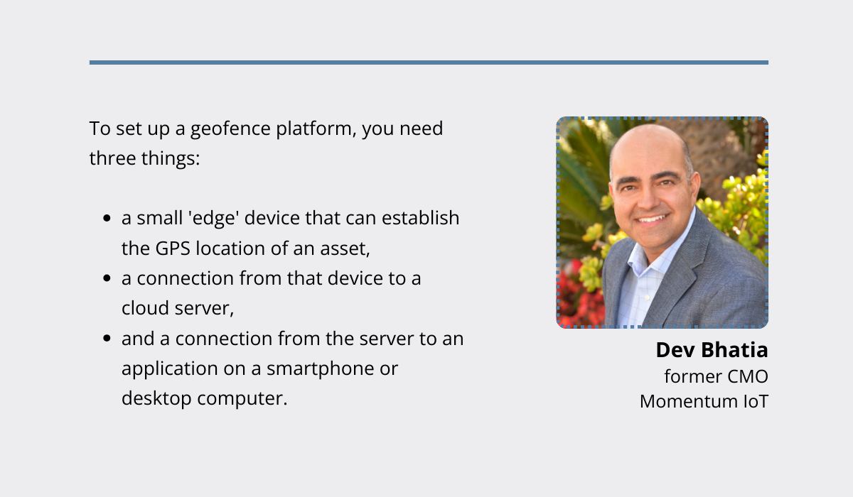
Here’s a breakdown of the process.
First, you need a robust geofencing software platform to define and manage virtual boundaries.
This software allows you to create geofences on a digital map interface through various methods.
It can be using polygonal geofencing software to identify points on a map, drawing circles around desired locations on platforms like Google Maps, or incorporating Google Earth to define boundaries on satellite views.
Next, you need to attach a GPS-enabled device to the asset, vehicle, or machinery you want to track.
This device communicates its location data to a cloud-based server via a cellular network, Wi-Fi connection, or satellite.
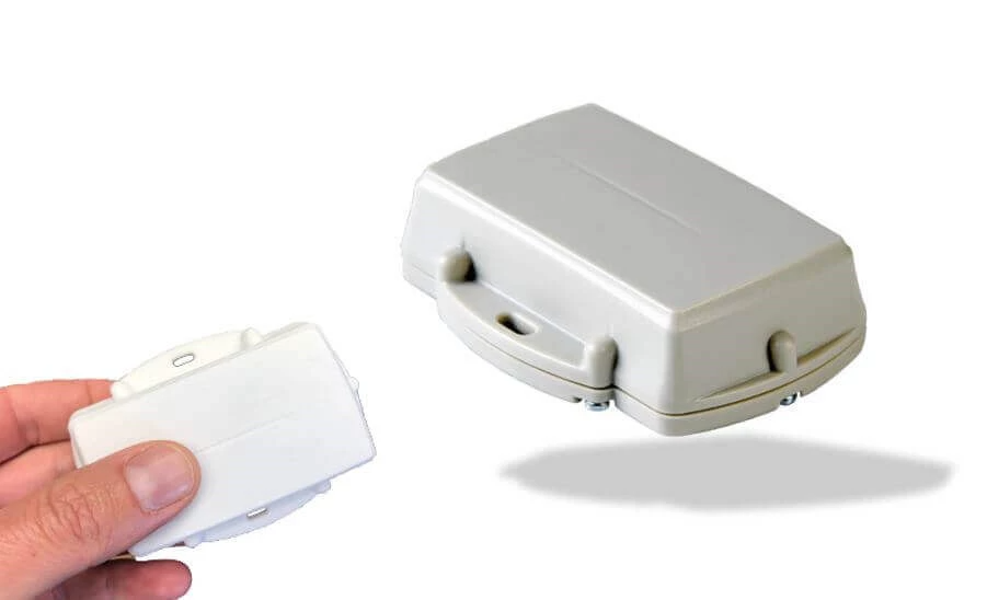
Whether it’s plugged into a vehicle’s power system or powered by small, portable batteries, it ensures real-time location updates.
Now, how does it all come together?
When an asset equipped with a GPS tracker crosses into or out of a geofenced area, the software detects this movement and triggers predefined actions or alerts.
These actions could include sending notifications to designated users via mobile apps or email, updating asset status in the system, or activating security measures.
But here’s the kicker: you don’t need to implement yet another software solution to enjoy the benefits of geofencing.
There are asset tracking software solutions out there that come with built-in geofencing features.
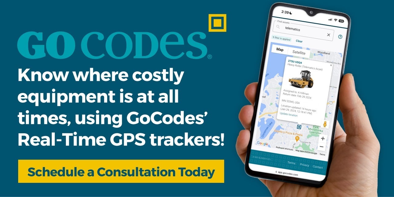
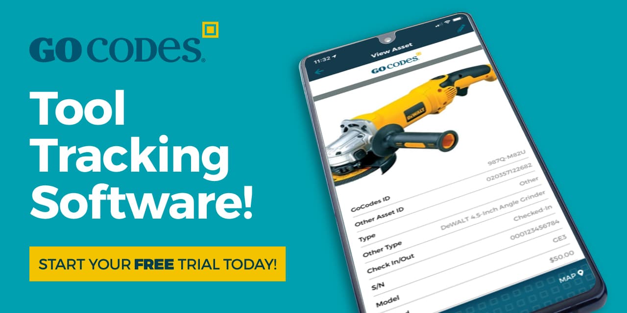
One of them is our GoCodes Asset Tracking—an all-in-one asset tracking solution that combines GPS trackers and geofencing features under one roof.
With GoCodes Asset Tracking, you can attach QR-coded labels to your assets for easy identification and GPS trackers to your high-value equipment for real-time location updates.
And when it comes to setting up geofences, GoCodes Asset Tracking makes it a breeze.
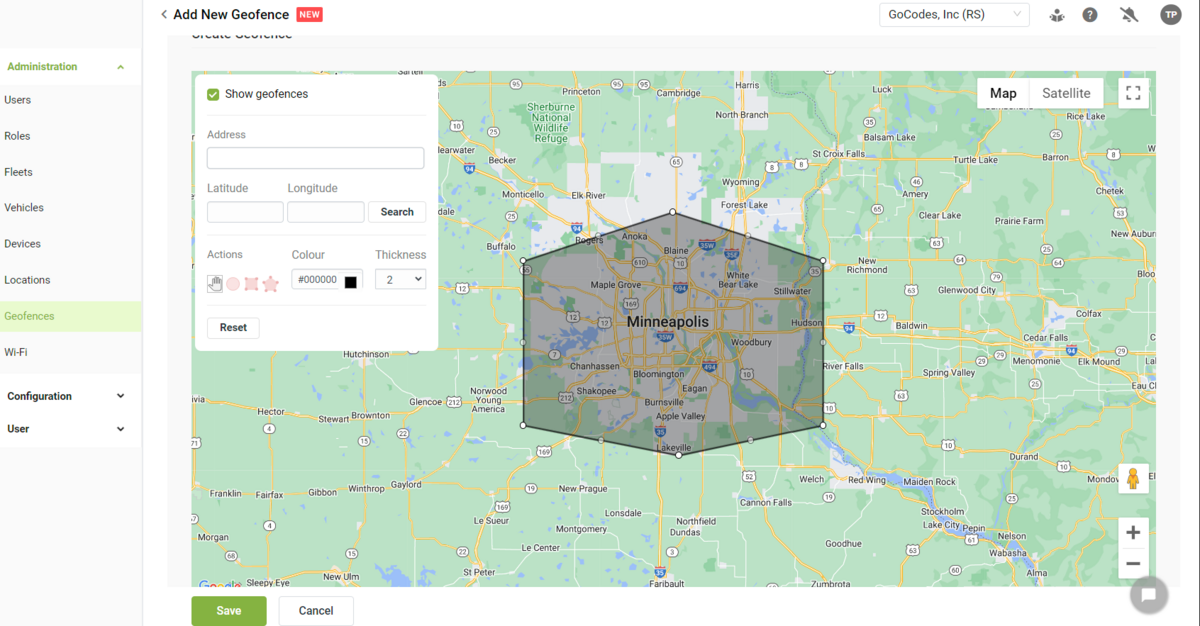
Simply pinpoint the area on the map, draw your virtual boundary, and voila!
You’re all set to receive instant alerts if any of your equipment strays outside the designated zone.
So, whether you’re monitoring vehicles, equipment, or other assets, geofencing simplifies the process and provides valuable insights into your asset management and security.
And we’ll dive deeper into its importance shortly.
But first, let’s explore the different types of geofences available.
Types of Geofences You Can Create
Three main types of geofences are commonly used: polygon, circular, and corridor.
Let’s explain each of them.
Polygon Geofences
Picture a digital fence that can adapt to fit any shape—this is precisely what polygon geofences offer.
These multi-sided boundaries are highly customizable, making them perfect for irregularly shaped areas like construction sites or properties.
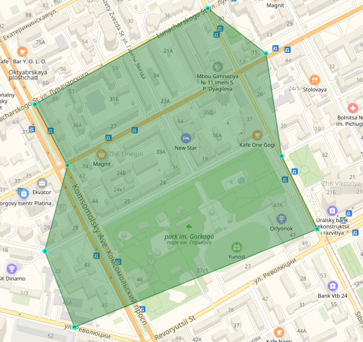
Suppose you’re overseeing the development of a new commercial building spanning multiple blocks with various features.
Here, polygon geofences allow you to define precise boundaries around the entire site, ensuring comprehensive coverage and accurate monitoring of all activities within.
Circular Geofences
As their name suggests, these boundaries are defined by a central point and a radius.
They are useful for creating simple, circular perimeters around assets or work zones, making them effective for protecting valuable equipment.
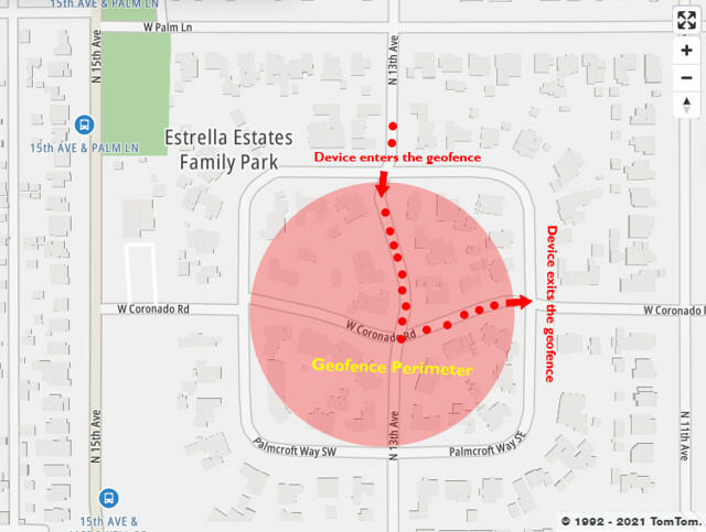
For example, if you manage a fleet of heavy equipment, circular geofences can be used to establish secure zones around each piece of equipment.
If a bulldozer or excavator ventures beyond the defined area, the system triggers an alert and lets you intervene quickly to prevent unauthorized use or theft.
Corridor Geofences
Corridor geofences are long, narrow boundaries typically used along transportation routes or pathways.
They are beneficial for monitoring vehicle movement along specific routes, such as delivery trucks or equipment transporters.
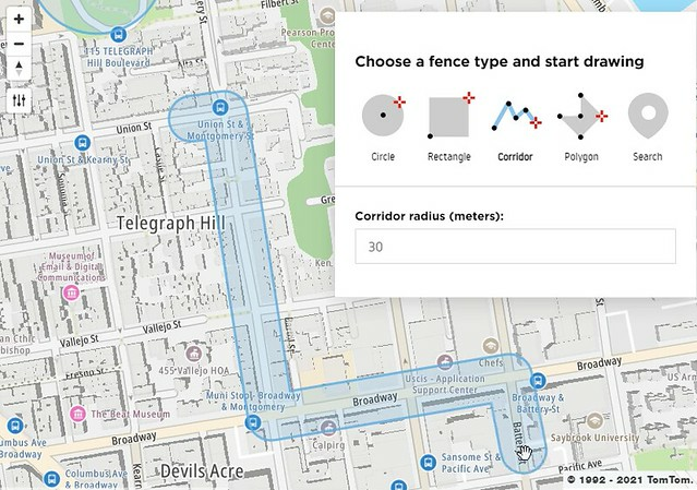
However, it’s essential to ensure that corridor geofences are slightly wider than the road to avoid unnecessary alerts.
For instance, you may not want to be notified every time a driver stops at a gas station—unless it’s crucial for your vehicle management.
Ultimately, the choice of geofence type depends on the unique characteristics and demands of your construction operations and the shape of your construction site, storage, or any other area you want to set up a virtual fence around.
Why Your Construction Company Needs Geofencing
Now, let’s address the most pressing question you likely have about this technology: why does my construction company need geofencing?
By now, we believe you’ve already caught a glimpse of the potential that geofencing can offer your construction company.
From safeguarding your construction sites from theft or vandalism to overall better management of your assets, geofencing can assist you in all these aspects.
Still—in the upcoming sections, we’ll outline three tangible benefits of geofencing that will convince you it’s high time to incorporate it into your construction operations.
Let’s start with what we consider the most critical aspect: improved security.
Improved Security
Construction sites are bustling centers of activity where valuable equipment and materials are in constant motion.
Unfortunately, they’re also prime targets for theft.
Just consider Labor Day 2023, when a staggering 179 equipment theft incidents were reported, resulting in losses exceeding $4 million.
Dealerships, storages, and worksites emerged as the top locations for these crimes.
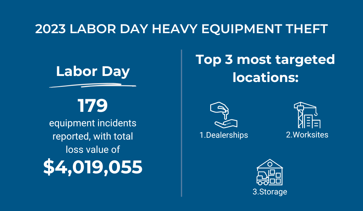
But here’s the silver lining: by creating virtual barriers around vulnerable areas like these, you can effectively prevent theft.
With nothing more than a digital fence, you can safeguard your storage facility or construction site.
How?
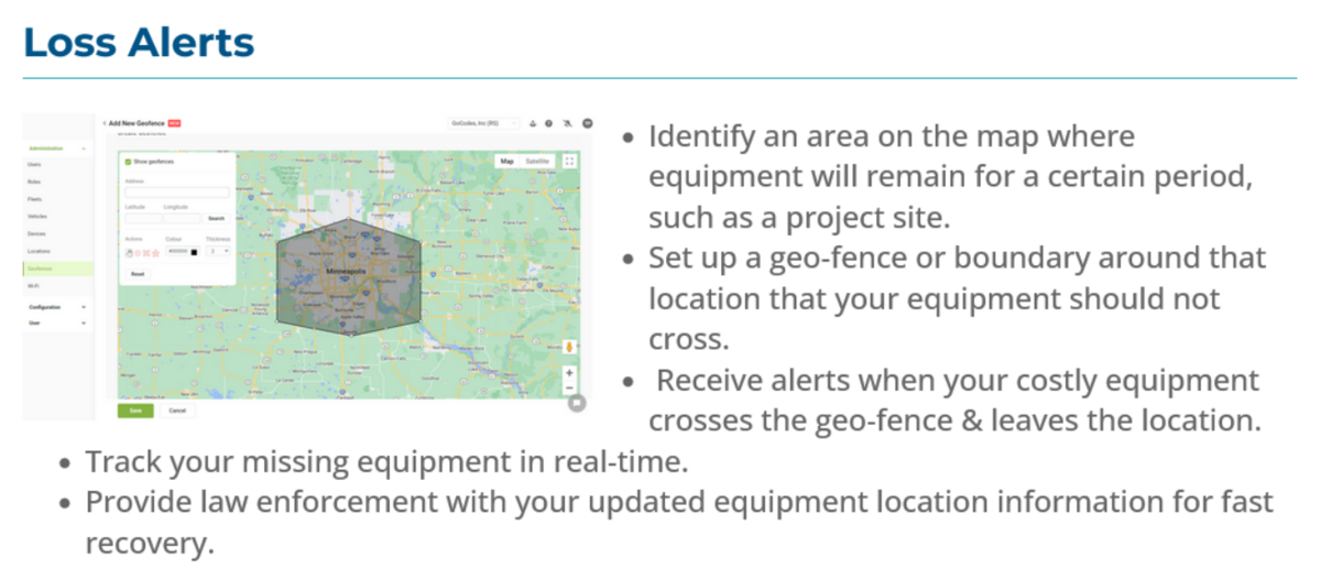
By using this technology, you will immediately receive an alert if your vehicles or other assets are moved outside the geofence, enabling you to take immediate action.
And when your vehicles or machinery is equipped with real-time GPS trackers like the ones GoCodes Asset Tracking can provide you with, you will not only get immediate alerts about your asset crossing the geofence.
No—you can also track missing equipment in real time and provide law enforcement with updated location information for a swift recovery.
But security is about more than preventing theft.
It’s also about ensuring the safety of your workers and the public.
By implementing geofencing, you can establish virtual safety perimeters around hazardous areas, reducing the risk of accidents and injuries.
Steve’s quote is a testament to that:
One strategy that has significantly improved our management is the integration of GPS and GIS technology for mapping and surveying the land accurately. This allows us to pre-determine the precise location of underground utilities, plan our projects better, and avoid unexpected issues. For instance, during an excavation, this technology helped us avoid hitting unrecorded pipes, saving both time and money.
Steve Sylva, Owner, Steve’s Services Landscape Company
And if you also equip your workers with wearable devices, you can make sure that both they and you receive real-time alerts if they enter danger zones.
This will prevent accidents but also foster a culture of safety and accountability on your construction site.
Take the rail industry, for example.
Geofencing technology has been instrumental in enhancing track worker safety by providing timely alerts when workers enter unsafe areas.
By leveraging geospatial data, organizations like AECOM are revolutionizing safety practices, using geofencing to manage project hazards and communicate risks effectively.
In essence, geofencing empowers you to protect your assets, safeguard your workers, and ensure the safety of the communities you serve.
This alone should be reason enough to leverage this useful technology.
Resource Optimization
In construction, efficient resource management is everything.
Every minute and every material counts toward the successful completion of a project.
And geofencing can optimize your resource game.
As we’ve emphasized throughout this article, geofencing empowers you to track the movement of equipment, materials, and personnel within specified zones.
In other words, through geofencing, you can monitor the real-time location of every asset and team member on your construction site.
And this level of visibility offers some concrete benefits.
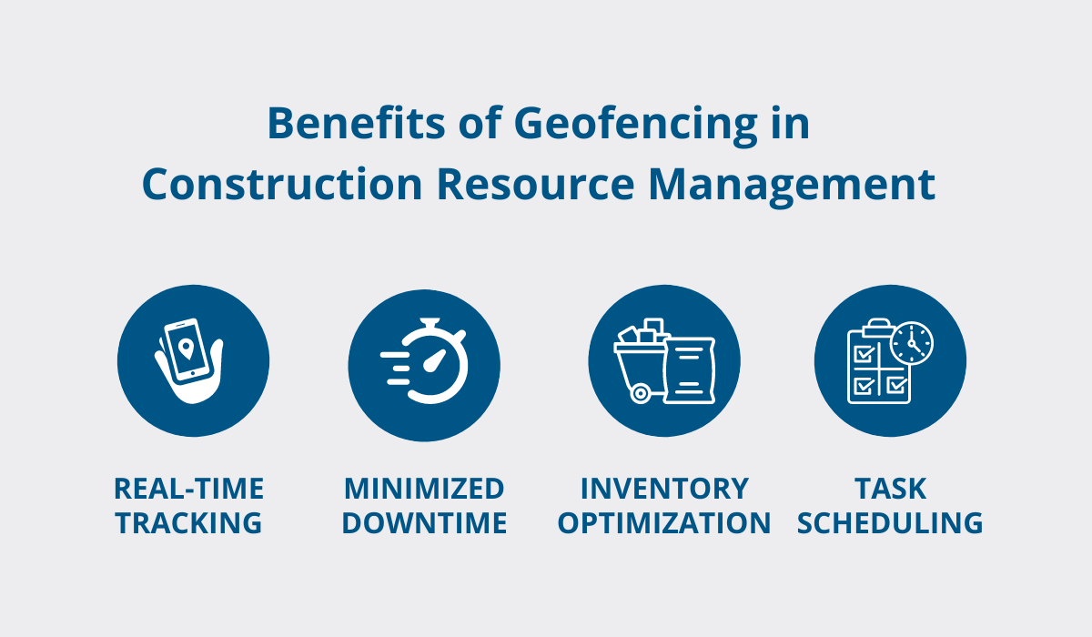
With geofencing, you can ensure that equipment and materials are where they need to be when they need to be there, thus minimizing downtime and maximizing productivity.
By tracking materials as they move in and out of designated areas, you can optimize inventory levels, reduce waste, and avoid costly shortages or overstock situations.
Or consider this scenario: you expect a crucial tool or team member to arrive at a specific construction site by 8 a.m., but no alert comes through indicating their arrival.
In this case, no alert “alerts” you to the deviation from the plan, allowing you to take swift action to address any issues and keep your project running smoothly.
Another way geofencing optimizes resource allocation is by enhancing task scheduling.
With geofencing technology, you can automate task assignments based on the real-time location of personnel and equipment.
For instance, if a delivery truck equipped with a GPS tracker enters the geofenced area of a construction site, the system can automatically assign unloading tasks to available workers stationed nearby, optimizing workflow efficiency.
To conclude, geofencing can be your ally in ensuring that resources are allocated efficiently, tasks are completed promptly, and your construction projects reach their full potential.
Data-Driven Decision Making
Did you know that a Deloitte survey found that 94% of construction companies recognize the transformative power of data analysis in shaping business decisions?
From cost reduction to operational efficiency and enhanced safety, the benefits are vast.
And guess what?
Geofencing is yet another tool to bring data, unlock these benefits, and make smarter, more informed decisions.
Think of geofencing as your trusty data companion, providing invaluable insights into the movements and activities of your workforce, equipment, and materials throughout every stage of your construction projects.
By diving into this data, you can uncover inefficiencies, anticipate potential challenges, and make decisions to streamline costs and elevate overall project performance.
Take, for example, the ability to monitor your construction team’s movements on-site using geofencing.
By setting up virtual boundaries around specific work areas, you gain real-time visibility into where your team is spending their time.
This allows you to pinpoint any inefficiencies, like prolonged idle times or suboptimal task assignments, and take swift action to course-correct, thus ensuring maximum productivity.
And let’s not forget about asset management and the power of real-time data.
With geofencing, you have eyes on your valuable equipment and materials at all times.
Should anything go astray and your assets cross geofences, you’ll receive instant alerts and access to real-time location data, enabling you to spring into action and minimize any potential disruptions to your project.
In summary, geofencing can be a game-changer for construction professionals like you, offering actionable insights and empowering you to drive efficiency, productivity, and success on every job site.
So why wait?
It’s time to harness the power of geofencing and take your construction operations to new heights.
Conclusion
As we wrap up our guide, it’s clear that geofencing is more than just a marketing gimmick—it’s a powerful tool for many industries, including construction.
By leveraging geofencing, you can revolutionize fleet, machinery, and asset management, all while boosting security and efficiency.
Embracing this technology empowers you to make smarter decisions, prevent theft, and optimize operations.
So, take charge of your construction sites with geofencing and unlock new levels of success.

