Construction Resources
Revolutionizing Construction Asset Management with GoCodes Asset Tracking
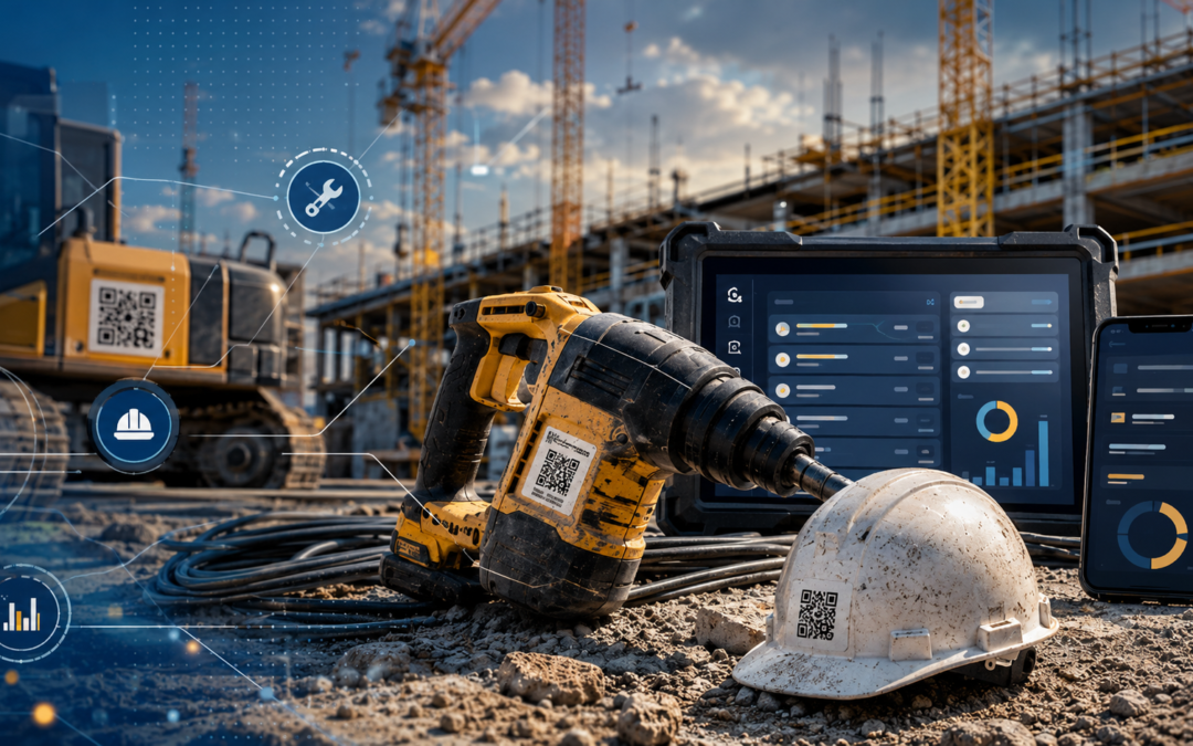
Any construction business will say that for projects to get completed on time requires that assets are on the ground, powered up and ready to go. The larger the construction company the more complex the logistics needed to manage millions of dollars of assets – including power tools and safety gear to large earth movers. Without asset tracking, equipment can be sent to the wrong project, get...
Revolutionizing Construction Asset Management with GoCodes Asset Tracking
Any construction business will say that for projects to get completed on time requires that assets are on the ground, powered up and ready to go. The larger the construction company the more complex the logistics needed to manage millions of dollars of assets – including power tools and safety gear to large earth movers. Without asset tracking, equipment can be sent to the wrong project, get...

5 Common Challenges of Construction Reporting
Want to improve your construction reporting process? These 5 challenges might be in your way. Learn how to spot and fix them.

Best Ways to Prevent Theft On Your Construction Site
Want to reduce theft-related losses? This article covers smart and proven strategies for construction site theft prevention.

Best Construction Material Management Software
Discover the top material management tools for construction teams. Our guide will show you how to track inventory.

Construction Daily Reports: Why They Matter and How to Write Them
Want to improve your construction reporting process? This article will show you why daily reports matter and how to create them effectively.

6 Types of Construction Project Management Software
Find out which types of software you should consider using if you want to elevate your approach to construction project management.

8 Biggest Cost Overruns Happened in Construction
We’re telling stories of some of the biggest construction projects that went way over the projected budgets.

How to Sell Your Construction Equipment in 6 Steps
We laid out the exact steps needed when selling construction equipment. Follow them, and the process will be easier than you think.

Pros and Cons of Construction Equipment Ownership
Explore the pros and cons that come with equipment ownership and find out which factors you should consider when deciding between the two.

The Effects of Poor Construction Material Management
Find out what consequences your construction company could suffer if you’re struggling with poor construction material management.

10 Statistics About Construction Equipment You Need to Know
The construction equipment industry is a key player in global infrastructure development. But this dynamic field is full of new technologies, shifting markets, and new trends that can be challenging to keep up with. If you're facing challenges like equipment selection, and investment decisions, or you’re simply trying to stay competitive, this article is for you. We prepared a concise overview...

9 Must-Know Statistics About Construction Project Management
Learn about the state of construction project management through the 9 fresh, must-know statistics we’re sharing in this article.

7 Key Steps of Construction Material Management
We’re guiding you through the steps you need to follow in order to successfully procure, manage, and track your construction materials.

How to Estimate Construction Equipment Costs
We’re sharing tips on how you can accurately estimate your construction equipment costs and explaining why this process is so important.

7 Must-Know Statistics About Equipment Rentals
Knowing the state of the equipment rentals market will help you make better decisions for your business. So check these statistics out!

Common Questions About Equipment Idle Time Answered
Wondering what kind of equipment sits idle the most? What causes excessive idle time, and how to reduce it? This article holds the answers.
6 Tools You Can Use for Tracking Construction Productivity
Explore our list of 6 tools from various categories that are bound to help you track productivity on your construction site with ease.

8 Compelling Statistics About Construction Productivity
Check our list of compelling statistics about construction productivity! They can guide your construction company on the way to success.

5 Factors Affecting Construction Efficiency
Wondering which factors can affect the efficiency of your construction operations? This article will provide the answers you’re looking for.

Top 7 Geofencing Software to Use on Your Construction Site
Discover the best geofencing software solutions and find out which one is the perfect choice for your construction site.

The Complete Guide to Geofencing in Construction
If you’re wondering what geofencing is, how it works, and why your construction company should invest in this technology, this is the article for you.

10 Best Construction Inventory Management Software
Discover the 10 best construction inventory management software solutions and find out which one is the right choice for your company.

Construction Inventory Management: What You Need to Know
Discover everything you need to know about construction inventory management: from what it entails to how you can improve your approach to it.

5 Effective Construction Cost Control Methods
This article explores five highly effective methods for controlling construction costs.

8 Tools for Construction Cost Management
In this article, we’re going to present you with 8 tools designed to help you better manage your construction costs. We will discuss the most important features of each tool, as well as the pros and cons of each.

Construction Cost Management: Step-by-Step Guide
This detailed guide to construction cost management will show you which steps you need to take in order to keep your construction projects within the defined scopes and budgets.

Top Challenges of Cost Control in Construction
This article dives into the common challenges you may encounter while trying to control the costs of your construction project. It also provides ideas on how to overcome them.

Construction Phase Plan: Things to Know
Let this thorough guide teach you everything you need to know about construction phase plans: from what they are and why you need them, to what elements they should encompass.

5 Reasons Why Cost Control in Construction Is Important
If you’re wondering why cost control plays such an important role in the success of construction projects, this article is for you.

Key Components of Construction Cost Management
Explore the essential components of construction cost management and uncover practical tips for improving its execution.

Construction Cost Planning: Advantages and Disadvantages
This article explores the nuanced landscape of construction cost planning, delving into its advantages and challenges.